The exact page text, read by your browser's voice.
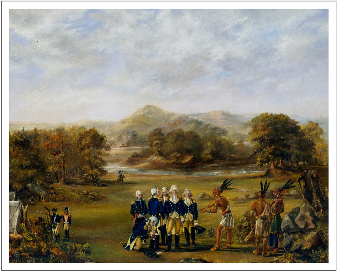

Tribes · the Native peoples of this ground
This section is the deep record of the peoples who held this ground before the city and who hold a claim on its history still: the Myaamia — the Miami people — whose capital stood where Fort Wayne stands, and the other nations whose villages, hunting grounds and council fires shared the three-rivers country. The city's own story is told in the Story; the battles are rostered in Wars; the land transactions, acre by acre, are in The Land; the emergence tradition, as the Myaamia tell it, is in Folklore. What this section holds is the tribal record itself: the people as a political nation — their towns, their chiefs, their treaty strategy, their removal, their survival in two modern governments, and their return to this ground in the present century. Names are given in the Myaamia language's modern orthography where the scholarship supplies it, with the older English spellings beside them. Where the sources disagree on a number — and on the hardest numbers, the population of Kekionga and the count of the removed, they do — the disagreement stands in the text rather than being silently settled.
The named world · Myaamiaki
THE PEOPLE · THE BANDS · THE LANGUAGE
The people the French wrote down as "Miamis," and the English as the "Twightwee" nation, call themselves myaamiaki — the downstream people, in the usual rendering — and their language myaamiaataweenki, a Central Algonquian tongue so close to the speech of the Illiniwek that linguists treat the two as one language complex, Miami-Illinois. The kinship the French noticed at first contact was real: the Miami bands and the peoples of the Illinois country shared language, clan structure and a tradition of common origin, and the Myaamia emergence account — told in full in Folklore — carries the people out of the waters at Saakiiweeyonki, on the river the French called the St. Joseph of Lake Michigan, near present South Bend. What the French met in the seventeenth century was not one village but a constellation of related bands. The principal band, the Atchakangouen or Crane band, held Kekionga. The Kilatika — in their own form, the Kineepikomeekwaki — held the towns of the Eel River and are carried in the records as the Eel River Miami, distinct enough that the United States sometimes treated with them as a separate party and kept an Eel River subagency whose letters, as late as the removal of 1846, were written from Fort Wayne. Down the Wabash stood the Wea — the Ouiatenon band, whose great town stood near present Lafayette — and below them the Piankeshaw, on the lower Wabash toward the Ohio. Early French lists name further bands — Mengakonia, Pepikokia — that fade from the record as the eighteenth century consolidated the nation into the Miami proper, the Eel River people, the Wea and the Piankeshaw, each with its own chiefs and towns, all answering, on the largest questions, to the council at Kekionga.
Sources: the Myaamia Center, Miami University (myaamia language and band usage); Stewart Rafert, The Miami Indians of Indiana: A Persistent People, 1654–1994 (Indiana Historical Society, 1996); Wheeler-Voegelin, Blasingham & Libby, An Anthropological Report on the History of the Miamis, Weas, and Eel River Indians (U.S. Indian Claims Commission record).
A homeland regained · the westward exile and the return
MID-1600s – c. 1700
The written record meets the Myaamia far from here, and the tribal record explains why. When French missionaries and traders first encountered them in the mid-seventeenth century, the Miami bands were living around the western shore of Lake Michigan and the St. Joseph River — driven west, the standard accounts hold and the tribe's own histories confirm, by the Iroquois wars that emptied the Wabash and Maumee valleys of settled peoples for a generation. The ground at the head of the Maumee was not new country to them; it was the old country, the land of the emergence account and of towns their grandfathers had known. Around the turn of the eighteenth century, as the Iroquois pressure ebbed and French traders pushed down from Canada with guns and goods, the bands moved back east and reoccupied it. The Crane band re-established its principal town at the confluence of the St. Joseph and St. Marys — the place where the Maumee begins and where a portage of roughly seven to nine miles in the period accounts — about nine miles in Croghan's 1765 journal and in the Myaamia record, seven in Poinsatte, eight on the 1959 Historical Society marker — the carrying place between the Great Lakes and the Wabash, made the town the hinge of the whole interior. The town was Kekionga — kiihkayonki, "blackberry patch," in the name the record keeps, though linguists have argued the etymology and the older sources carry other forms. The return matters to everything after: the Miami who treated with the United States a century later were not newcomers defending a recent conquest. They were a people back in a homeland their own tradition said they had come out of the water to inhabit, and they said so, on the record, at the treaty councils.
Sources: Rafert, The Miami Indians of Indiana (1996); Helen Hornbeck Tanner, Atlas of Great Lakes Indian History (1987); the Myaamia Project / Myaamia Center historical essays (Aacimotaatiiyankwi, the tribe's community history blog); Michael McCafferty, Native American Place Names of Indiana (2008), on the Kekionga name debate.
Kekionga · the capital
c. 1700 – 1794 · THE COUNCIL SEAT
How old Kekionga is, the record argues about; what it was, the record is plain. The town is documented from the opening years of the 1700s, when Jean Baptiste Bissot, sieur de Vincennes, appointed in 1696 to command the French posts of the northeast, settled first on the St. Joseph and then, by 1704 in most accounts, established his trading post and fort among the Miami at Kekionga — some accounts put a French presence in the 1680s, and the honest statement is that the town was certainly the nation's capital by the first decade of the century and may be older. It was the largest Native town in what is now Indiana. Its permanent works were a large council house where the nation's councils met, and around the confluence stood not one village but a cluster — the "Miami Towns," Harmar's officers called them in 1790, counting seven distinct villages in the vicinity, and Major Ebenezer Denny's map of that year drew eight, ringed by some five hundred acres of cornfields, with "vast fields of corn in almost every direction." The town was never only Miami. Large Shawnee and Delaware villages stood within the cluster in 1790; traders — French first, then British and American — kept houses there; the Girty brothers lived three miles off; and in the winter of 1789–90 the traders Henry Hay and John Kinzie wintered in the French-speaking village and left a journal of dances, Masses and council talk with Pacanne, Little Turtle, Blue Jacket and Le Gris. A French count of 1744 put about a thousand Miami in the post's orbit beside some forty Frenchmen; modern estimates of the town cluster's population at its height commonly run between one and two thousand, and no exact figure exists. The trade figures stand proxy for its weight: in 1790 the governor of Canada warned London that Kekionga produced two thousand packs of pelts a year worth some £24,000 sterling, twice the value of the Detroit–Lake Huron trade. Little Turtle, at Greenville in 1795, gave the town its own description: "that glorious gate … through which all the good words of our chiefs had to pass from the north to the south, and from the east to the west." Smallpox broke it twice — an epidemic emptied the town for a year in 1733, and another killed the chief Cold Foot in 1752 — and faction broke it once, when the pro-British chief La Demoiselle led his people off to Pickawillany in 1749 and set Miami against Miami until Pickawillany's destruction in 1752 brought the survivors home. But for ninety years every power that wanted the interior — French, British, American — had to come to Kekionga and treat with the council there.
Sources: Charles Poinsatte, Outpost in the Wilderness: Fort Wayne, 1706–1828 (1976), for the trade figures, the Greenville quotation and the Hay–Kinzie winter; Ebenezer Denny's Military Journal (1859), for the 1790 map and description; George Croghan's 1765 journal ("about 40 or 50 Cabins besides nine or ten French Houses"); Colin G. Calloway, The Victory with No Name (2015), on the Shawnee and Delaware villages within the cluster; Rafert (1996). Population figures are given as the estimates they are.
The other nations on this ground
POTAWATOMI · DELAWARE · SHAWNEE · ODAWA · THE IROQUOIS CLAIM
Kekionga was a Miami capital, but the three-rivers country was never Miami ground alone, and the record names the neighbours precisely. The Potawatomi held the St. Joseph River country to the north and west — their towns stood along that river toward present South Bend and into Michigan, their canoes worked the same portages, and Potawatomi chiefs sat in the councils and signed at the treaty grounds at Fort Wayne and St. Mary's through the whole treaty era; their own removal, when it came in 1838, ran west from the Twin Lakes country in Marshall County, not from this ground, and the Pokagon Band's exemption from it is a Michigan story. The Delaware — the Lenape, themselves removed westward in stages from the east — kept large villages inside the Kekionga cluster in the 1780s and 1790s and their main Indiana towns on the White River, and Delaware warriors were a mainstay of the confederacy that twice destroyed American armies on this ground. The Shawnee, likewise pushed west from the Ohio country, had villages among the Miami Towns and supplied, in Blue Jacket, the confederacy's other great war leader. Earlier still, an Odawa town — the Kiskakon band, whose name some sources give as Kekionga's own earlier form — stood on the Maumee in the years before the Miami return, and Odawa traders were fixtures of the town thereafter. Behind all of it lay the Iroquois claim: the Five Nations asserted a right of conquest over the whole Ohio country, a claim the British bought at Fort Stanwix in 1768 and the United States inherited, and the western nations' flat rejection of it — the land was theirs by occupancy, not the Iroquois' to sell — was the legal heart of the war of 1790–94. Wyandot, Seneca-Cayuga and other nations' warriors fought in the confederacy's armies and their chiefs spoke at its councils, but as residents of this ground their footprint is the council fire and the war party, not the town.
Sources: Calloway, The Victory with No Name (2015); Tanner, Atlas of Great Lakes Indian History (1987); R. David Edmunds, The Potawatomis: Keepers of the Fire (1978); Poinsatte (1976), on the Kiskakon name question; the treaty record as carried in The Land.
Pacanne · the chief who kept the town between empires
c. 1764 – 1816 · CIVIL CHIEF OF KEKIONGA
The Miami governed themselves, in the form the record shows, through two kinds of authority: civil chiefs, who kept the towns, the councils and the peace, and war leaders, raised for a campaign and obeyed for its length. Pakaana — Pacanne in the English record — was the civil chief of Kekionga for half a century, and his career is the political history of the town from the end of French rule to the end of the confederacy. He emerges in 1764, in the aftermath of Pontiac's War, when his sparing of the captured British officer Thomas Morris — carried in the record as the act that made his name — set Kekionga's course of accommodation with the incoming British. Through the Revolution he steered the town between the British at Detroit, who fed its trade, and the Americans, whose raiders — La Balme's men in 1780, destroyed by the town's warriors on the Eel River — learned what the town's neutrality cost to break. Henry Hamilton sketched him in 1778. He counseled at Kekionga through the confederacy years but the war leadership belonged to younger men; and at the end, significantly, Pacanne did not go to Greenville in 1795. He sent his nephew — Jean Baptiste de Richardville, his sister Tacumwah's son — to make the peace in his place, a delegation the full biography in People weighs. He lived on as principal civil chief until his death in 1816 (one modern Fort Wayne account implies 1814; the longer date is the standard one), and the succession he had arranged — civil authority passing within the same ruling family, from Pacanne to Richardville — is the frame of the treaty era that followed.
Sources: the full biography of Pacanne is in People; this entry follows Rafert (1996), Harvey Lewis Carter, The Life and Times of Little Turtle (1987), and the town's record as carried in the Story and Wars.
Little Turtle · the statesman
c. 1752 – 1812 · WAR LEADER, THEN THE NATION'S VOICE
Mihšihkinaahkwa — Little Turtle — was born about 1752 (the year is argued; 1747 also appears) at his father's town on the Eel River, in the country of present Whitley County, and he was a war leader, not a hereditary civil chief: his authority was earned in the campaigns that are rostered in Wars — La Balme's destruction in 1780, the ruin of Harmar's army in 1790 and of St. Clair's in 1791, the greatest victories any Native confederacy ever won over the United States. What belongs to this section is the second career, the political one, which the Miami record treats as the greater. At Greenville in 1795 Little Turtle argued the confederacy's case against the cession line for days — objecting, on the record, that the proposed boundary took land the assembled nations had no right to cede — and then signed, and spent the remaining seventeen years of his life working the peace he had signed: journeys east in 1797–98, when President Washington received him and presented the sword the stories section examines, and again in 1801–02 to President Jefferson; a public campaign against the liquor trade that was destroying his people, pressed on Congress and the Quakers alike; and support for the Baltimore Quakers' model farm on the Wabash, the "civilization" programme he treated as the nation's best remaining instrument. The accommodation had a price at home — younger chiefs and the Prophet's movement read it as surrender — and it did not stop the land cessions, which is the tragedy the next entries record. He died on 14 July 1812 at the Fort Wayne home of his son-in-law, Captain William Wells — the American agent and interpreter who was himself Miami-raised, nephew by marriage and by adoption into the nation — and was buried with military honours by the United States garrison. His grave, found on Lawton Place in 1912, and the goods buried with him are the stories section; what stands here is the political fact: with Little Turtle dead in 1812 and Pacanne dead in 1816, the nation's leadership passed to a generation that would have to negotiate not the boundaries of its country but the terms of its disappearance from it.
Sources: Carter, The Life and Times of Little Turtle (1987); R. David Edmunds, "The Many Faces of Little Turtle" and the Greenville council record; the grave and sword record is in the stories section; Wells's career is in the Story and People.
Greenville from the council side
1795 · THE FIRST CESSION
The Treaty of Greenville, signed 3 August 1795 after Wayne's victory at Fallen Timbers, is usually told as an American instrument; from the council side it was the confederacy's reckoning with a war it could no longer feed. The nations ceded the southern two-thirds of present Ohio and a string of reserved tracts at the portages and posts — including the Kekionga portage itself, the carrying place that was the town's wealth, which the treaty opened to American use and around which the United States took its six-mile-square reserve. Little Turtle's objection, entered in the council minutes, went to the title itself: much of the ceded country, he argued, belonged to nations not present or not consenting. The objection was overruled and the line drawn, but two things in the Miami reading of Greenville mattered for fifty years: the treaty recognised the remaining country north and west of the line as Indian land, guaranteed against American purchase except by treaty with the nations themselves; and the annuity system it began — yearly payments in goods and cash — became the lever every later negotiation pulled, the payments withheld or promised as pressure required. The figures of the cession are in The Land. The politics are here: Greenville was the last treaty the Miami signed as a power that had to be defeated first. Every treaty after it was signed by a nation being managed.
Sources: the Greenville council record (American State Papers: Indian Affairs); Carter (1987); Rafert (1996); cession figures cross-referenced to The Land.
The squeeze · the treaty line, 1803–1818
1803 – 1818 · CESSION BY CESSION
Between Greenville and 1818 the United States took Indiana a slice at a time, and the councils of those years show the Miami learning the system's rules in real time. The Fort Wayne treaties of 1803 and 1809 — the second of them Governor Harrison's great purchase, signed at Fort Wayne and Vincennes, which took some three million acres of the Wabash and White River country — were negotiated with the Delaware, Potawatomi, Eel River and Miami together, and it was at the 1809 council that the federal method stood fully revealed: assemble every nation with any colour of claim, buy the same land from all of them, and let the intertribal quarrel over title do the work of conquest. The Shawnee Prophet's and Tecumseh's answer to that method — that the land was held in common and no single nation could sell it — was the last military argument the old confederacy made, and it died at Tippecanoe in 1811 and in the War of 1812, in which the Miami, divided and courted by both sides, saw their Mississinewa towns burned by American detachments in December 1812 even as their chiefs negotiated. The Treaty of St. Mary's in 1818, the "New Purchase," took the whole centre of Indiana and left the Miami with the Big Reserve — a tract of some 760,000 acres in the Wabash–Mississinewa country south and west of Fort Wayne — plus a mosaic of smaller reserves. The political meaning of 1818 is that the nation had ceased to be a country with borders and had become an estate: a shrinking island of tribal land in a sea of cession, whose defence would now be conducted not by war leaders but by lawyers, traders and one very able chief. The transactions themselves, treaty by treaty and acre by acre, are in The Land.
Sources: the treaty record (Kappler, Indian Affairs: Laws and Treaties); Rafert (1996); Edmunds, The Shawnee Prophet (1983), for the common-title doctrine; cession figures cross-referenced to The Land.
Richardville's system · the reserve strategy
1816 – 1841 · PRINCIPAL CHIEF
Pinšiwa — Jean Baptiste de Richardville, born about 1761 at Kekionga, son of the French trader Antoine-Joseph Drouet de Richerville and Tacumwah, Pacanne's sister — succeeded his uncle as principal civil chief in 1816 and held the office until his death in 1841, and his system was a deliberate answer to the squeeze: if the land could not be held, it would be converted, at the best price obtainable, into forms that could — annuities, cash, and above all individual reserves, tracts granted by treaty to named persons and held by patent outside the tribal estate the next treaty would take. The full biography, and the fortune, are in People and Wealth; the tribal-political record is this. Richardville treated at St. Mary's (1818), at Mississinewa (1826), at the Forks of the Wabash (1834 and 1835, and 1838) and in the final treaty of 1840, and across those instruments he and his family accumulated grants totalling some 28,320 acres while the tribal domain shrank to nothing. The strategy was not his alone and was not simple self-enrichment, though it made him, by the reckoning of the time, among the wealthiest men in Indiana: the reserves were the mechanism by which particular families — his own, the Godfroys, the LaFontaines — could remain in Indiana legally when removal came, and he used treaty after treaty to widen the list of the protected. His fellow chiefs understood the bargain and some resented it; the United States understood it too, and paid for his signature accordingly. In 1831 he moved the tribal headquarters from Fort Wayne to his trading post at the Forks of the Wabash, by present Huntington — the nation's centre of gravity following its remaining land southwest, away from the town its grandfathers had made a capital. He died on 13 August 1841 at his house on the St. Marys southeast of the city, thirteen months after signing the treaty that ended the Miami as an Indiana landowner. What that treaty spared — his family's reserves — still bears his name on the map of Allen County.
Sources: the full biography is in People and the fortune in Wealth; treaty-by-treaty political narrative follows Rafert (1996) and Bert Anson, The Miami Indians (University of Oklahoma Press, 1970); acreage as carried in People (28,320 acres, grants across the treaty line).
The exempted · the families who could stay
1838 – 1850 · THE EXEMPTION SYSTEM
When removal came, who stayed was decided years in advance, on paper, by the exemption system Richardville's strategy had built. The treaties of 1838 and 1840 excepted named families and their patented reserves from the general removal: the Richardville family, holding its Allen County and Forks reserves; the family of Francis Godfroy — Palaanswa, the war chief turned trader whose great reserve and trading post stood on the Mississinewa at present Mount Pleasant, and whose line, through his sons, remained a centre of the Indiana Miami for generations (the Slocum connection belongs to Peru ground: Frances Slocum, the white captive raised Miami, married into the Deaf Man's village on the Mississinewa, and her family's 1845 petition to Congress won its own exemption — one line here, because her ground is the Mississinewa, not Fort Wayne's); and the band of Meshingomesia — Mihsiinkweemisa, "Burr Oak" — son of Metosina, whose ten-square-mile reserve on the Mississinewa, reserved in 1838 and patented to him in trust for his band in 1840, was the only one of the exemptions held communally, as tribal land. A further exemption, won by petition rather than treaty, covered the family of Frances Slocum; and in 1850 a joint resolution of Congress added the names of more families — the Osandiah, Mezequah, Seek, Black Raccoon, Black Loon, Rivarre and Langlois lines among them, 101 persons in that instrument alone. The counts of the exempted were never kept consistently, and this section carries them as the sources give them: the scholarly count in the Indiana Magazine of History puts the exemptions, across the instruments, at 161 individuals; the National Register record puts those allowed to remain by the acts of 1838–1845 at 148; the count carried in this history's People section is 126 remaining in 1846, 43 of them Richardville's family. The figures measure slightly different sets at slightly different dates; what they agree on is the scale — between a third and a half of the nation in Indiana had a legal right to stay.
Sources: National Register nomination, Meshingomesia Cemetery and Indian School Historic District (Grant County), for the 1838/1840/1845 instruments, the 1850 joint resolution and the 148 figure; Glenn A. Black / Sarah Jane Line and the IMH record for Meshingomesia's band; "Chief Francis LaFontaine and the Miami Emigration from Indiana," Indiana Magazine of History, for the 161 exemption count; Rafert (1996).
The 1840 treaty · the council agrees to go
28 NOVEMBER 1840 · FORKS OF THE WABASH
The Treaty of the Forks of the Wabash, signed 28 November 1840, closed the tribal estate in Indiana: the Miami ceded the Big Reserve, the last tribal land in the state, in exchange for land west of the Mississippi and $550,000 in payments and provisions, and agreed to remove within five years. The exemptions of the previous entry were written into and around the instrument — including, in its seventh article, the patent of the Meshingomesia reserve to Meshingomesia in trust for his band — so that the treaty that ended the nation in Indiana simultaneously created the legal remnant that would outlast it there. The five years became six: the nation delayed, negotiated, sold property slowly and petitioned, and the federal government, impatient by 1846, applied the annuity lever — no payments until the emigration was complete — and ordered troops to the gathering ground at Peru in September 1846. The old chiefs were gone: Richardville five years dead; the nation would make the journey under his elected successor. What the treaty means in the tribal record is double, and the tribe's own commemoration work holds both truths at once: a capitulation extracted under pressure no council could have withstood indefinitely — and an instrument whose exemption clauses, fought for line by line, are the reason there is an Indiana Miami story after 1846 at all.
Sources: the treaty text (7 Stat. 582); Myaamia Center / Miami Tribe of Oklahoma, myaamiaki aancihsaaciki: A Cultural Exploration of the Myaamia Removal Route (2011); Miami Nation of Indians v. Lujan, 832 F. Supp. 253 (N.D. Ind. 1993), for the treaty's exemption patents as recited by the court; figures cross-referenced to The Land.
LaFontaine · last principal chief of the united tribe
1841 – 1847 · TOOHPIA
Toohpia — Francis LaFontaine, "Frost on Leaves," born about 1810 near Fort Wayne (one county history says 1820; the weight of the record supports c. 1810), of a French father and a Miami mother, chief of his own village at eighteen and married to Richardville's youngest daughter Catherine — was elected principal chief at the council of 1841, defeating among others Meshingomesia, and inherited the removal. His six years were the administration of a dissolution he had not chosen: preparing the emigration, defending the exemptions, and holding together a nation that the 1840 treaty had already, in effect, sawn in two. When the boats loaded in October 1846 LaFontaine, himself exempt, went with the removed — the council in Kansas re-affirmed him as principal chief that December and petitioned President Polk to retain and recognise him — and in the spring of 1847 he started home to the Forks of the Wabash. He never arrived. He died on the return journey at Lafayette, Indiana, in April 1847 — the 13th in the county histories and the Indiana Magazine of History account, the 15th in the tribe's own later research, which also records that the Kansas council, displeased with his handling of annuity money, had elected Oonseentia in his place five days before; rumours of poison, carried in the standard biography, were never proven and are recorded as rumour. He was buried at Huntington, in the ground that is now Mt. Calvary Cemetery. With him ended the office of principal chief of the united Miami nation: after 1847 there are two Miami stories, and this section follows them separately.
Sources: "Chief Francis LaFontaine and the Miami Emigration from Indiana," Indiana Magazine of History; Brant & Fuller, History of Miami County (1887) and History of Huntington County, for the 13 April 1847 date and burial; Myaamia Center community history (Aacimotaatiiyankwi), "Continued Movement between Indiana and the Miami Reservation" (2021), for the 15 April date, the Oonseentia election and the Kansas council's petition; the LaFontaine record is summarised from these.
Removal · October 1846
6 OCTOBER – 5 NOVEMBER 1846 · THE FORCED REMOVAL
The removal of the Miami, when it finally came, came by water, on the canal the nation had watched cut through its own land. Through the summer of 1846 the emigration agents — the contractors were the trading firms of the Ewing interest and Alexis Coquillard of South Bend — gathered the people at a camp at Peru, on the straight reach of the Wabash the Miami called Iihkipihsinonki, "the Straight Place"; witnesses described families taking handfuls of earth from their ancestors' graves to carry west. In September the army arrived — a small detachment sent from Cincinnati, encamped at Peru on 22 September — and the annuities stayed stopped, and delay ended. On 6 October 1846 the loading began. The counts of the boats differ in the record and are carried here as they stand: the Indiana Magazine of History account, from the agents' correspondence, loads three canal boats at Peru; the emigration letter written from Fort Wayne on 7 October, from the office of the Eel River Subagency, reports five boats passing through that place on their way to Cincinnati. The party numbered, in the tribal commemoration's figure and the Eiteljorg record's alike, over 320 people — 327 in the count most often printed — out of a nation in Indiana of perhaps twice that, the exempted families standing on the bank. The boats passed Fort Wayne on the second day, taking aboard those gathered there, and ran the Wabash and Erie Canal into Ohio, then turned south on the Miami and Erie Canal to Cincinnati. There the people were transferred to the steamboat Colorado, down the Ohio and up the Mississippi to St. Louis, where they were held three days on Bloody Island; then onto the Clermont No. 2, up the Missouri to Kanza Landing — present Kansas City — arriving 1 November 1846; then fifty miles overland by wagon and horseback to the Miami reservation on Sugar Creek, in present Linn County, Kansas, arriving 4–5 November. The tribe's own accounting of the journey's cost: at least seven people died on the road — six children and an elder man, in the commemoration's words — and at least twenty-three more died within the first two months on the Sugar Creek reserve. Two babies were born on the journey. The removed were not the whole nation, and the story of those who stayed is below; but for the families on the boats, the removal was what the Myaamia language now names it in the tribe's commemoration: aancihsaaciki, the forced move, whose effects, in the tribe's own words, "are still felt throughout our community today."
Sources: Miami Tribe of Oklahoma, myaamiaki aancihsaaciki: A Cultural Exploration of the Myaamia Removal Route (2011) and the Myaamia Center's removal commemoration essays (Aacimotaatiiyankwi, 2020–2024), for the route, the deaths and the two births; "Chief Francis LaFontaine and the Miami Emigration," Indiana Magazine of History, for the agents' correspondence, the Peru camp, the troops and the three-boat loading; the emigration letter of 7 October 1846 (Office of Eel River Subagency, Fort Wayne), for the five boats; the Eiteljorg/Indiana timeline record for the 327 count. Boat and total counts are carried with their sources, unreconciled, because the record does not reconcile them.
The second removal, and the returns
1847 AND AFTER · THE DOOR NEVER QUITE CLOSED
Removal was not a single departure but a process that ran for years in both directions. Not everyone gathered in 1846 stayed gathered: some fled the Peru camp — to Michigan, in some accounts — and some who made the journey came back, as the exempted LaFontaine had intended to, to family reserves in Indiana. In 1847 the government ran the sweep again: the contractor Coquillard collected, by his own report, seventy-eight people, "every thing in the shape of an Indian in the country" — a phrase whose completeness the survival of the Indiana Miami refutes — and sixty-one of them were delivered to the sub-agent at the Kansas reservation on 10 September 1847, among them many who had fled the first removal and families of those who had returned in the spring. And still the movement continued at family scale for decades: Kansas Miami visiting Indiana kin, Indiana Miami removing west to join the tribal roll, annuity business pulling people both ways along the same canal-and-river road the boats had taken. The demographic result, by the 1850s, was a nation in two places with two different legal fates, each regarding the other as its own people — a division the governments of both halves have spent a century and a half alternately honouring and contesting.
Sources: Myaamia Center community history, "Continued Movement between Indiana and the Miami Reservation" (2021), for the 1847 collection, the 61 delivered and the return movement; Indiana Magazine of History, Lafontaine article, for Coquillard's correspondence.
Kansas, then Oklahoma · the western nation's road
1846 – 1873 · SUGAR CREEK TO INDIAN TERRITORY
The removed Miami reached a reservation on Sugar Creek, in the Marais des Cygnes country of present Linn County, Kansas — land already filling with white settlement pressing in from Missouri, on which the tribe rebuilt its council, its farms and its dead-ground through the Kansas territorial years. The western nation's separate treaty history runs through the 1854 treaty at Washington, signed the same June week as the Indiana treaty that recognised the eastern remnant — the two halves of the nation treating with the United States in parallel, a constitutional oddity the next entry takes up — and through the Civil War years, when Kansas Miami families again divided under pressure. In 1867 the western Miami signed the treaty that traded Kansas for a new reservation in Indian Territory, in the intertribal lands of present Ottawa County, Oklahoma; the removal there was completed by 1873, to the town that took the nation's own name — Miami, Oklahoma — beside the Peoria and the other removed nations of the old Northwest. There the tribal government that removal had carried out of Indiana in the canal boats continues unbroken: the United States has recognised the western tribal government continuously since 1846, and the Miami Tribe of Oklahoma today is that government — the same national council, by its own account and the federal record alike, that Pacanne kept and Richardville led, seated now a thousand miles from Kekionga.
Sources: Miami Nation of Indians v. Lujan, 832 F. Supp. 253 (N.D. Ind. 1993), for the parallel 1854 treaties and the continuity of federal recognition of the western government since 1846; the Miami Tribe of Oklahoma's published tribal history (Miami Nation News / Aatotankiki Myaamiaki); Rafert (1996) and Anson (1970) for the Kansas decades.
The Indiana remnant · the last tribal land
1846 – 1881 · MESHINGOMESIA'S RESERVE
The Miami who stayed lived, at first, as the treaties had arranged: on the patented family reserves scattered from Allen County down the Mississinewa, a population the counts put between roughly 125 and 150 souls. Their centre was the one communal holding, Meshingomesia's reserve — ten square miles on the Mississinewa in present Grant and Wabash counties — and their leader, for thirty-two years, was Meshingomesia himself, who assumed the role of lead chief of the Indiana Miami and held it until his death on 16 December 1879, aged, by his monument's reckoning, about ninety-eight. The reserve's end came by the same paper road as its creation: in the 1870s members of the band — Thomas Richardville, a Miami of the chief's own extended family world, prominent among them — petitioned Congress for division of the land into individual allotments, against Meshingomesia's counsel, which the band's own tradition preserves as prophecy of the result. By the act of 1 June 1872 Congress authorised the partition; commissioners allotted the reserve in severalty among the band's entitled members — sixty-three persons in the Wabash County portion by the county history's count — with patents that could not be sold until 1 January 1881, after which the allotments became taxable. What followed was the standard allotment-era story told in one small place: tax sales, debt sales, and piecemeal alienation, until, in the Wabash County history's bleak summary, the band's entire remaining ownership "consists of but eight acres, out of the hundreds given them so short a time ago." The cemetery and the Indian school ground of the reserve survive, in continuous Miami ownership, as the Meshingomesia Cemetery and Indian School Historic District — the ground itself listed on the National Register, and the standing physical remnant of tribal Indiana.
Sources: National Register nomination, Meshingomesia Cemetery and Indian School Historic District; Sarah Jane Line, "The Indians on the Mississinewa," Indiana Magazine of History, for the reserve's boundaries, the 1872 act and Meshingomesia's death (16 December 1879); Weesner, History of Wabash County (1914), for the partition commissioners, the sixty-three entitled persons and the eight-acres summary; Miami Nation of Indians v. Lujan, for the allotments' taxability by 1881.
A persistent people · the recognition fight
1854 – 2002 · THE EASTERN MIAMI AND THE UNITED STATES
The Indiana remnant's legal story is the longest unfinished file in this record. In the treaty of 5 June 1854 the United States treated with the Indiana Miami as a tribe and listed, in the revised fourth article, the named persons entitled under the exemption patents — federal recognition, in treaty form, of the eastern group as a distinct party. In 1897 that recognition was withdrawn by an administrative opinion: Assistant Attorney General Willis Van Devanter — later a justice of the United States Supreme Court — held on 23 November 1897 that the Indiana Miami's remaining lands were individually owned, that they were therefore "citizens and not Indians under federal law," and the Interior Department withdrew acknowledgment. The tribe reorganised for the fight: on 30 September 1937 the Miami Nation of Indians of the State of Indiana was established as its standing organisation, headquartered at Peru. Restoration bills failed in Congress repeatedly from 1938 onward. The modern acknowledgment process gave the fight its final form: a petition filed in the 1980s, a proposed finding against the tribe in 1990, and on 9 June 1992 the Bureau of Indian Affairs' final determination that the Indiana Miami did not exist as a tribe entitled to a government-to-government relationship — resting, in the words of the Federal Register, on insufficient evidence of a distinct community and of tribal political process since the early 1940s. The tribe marched from Peru to South Bend in September 1992 and sued; in July 1993 Judge Robert L. Miller Jr. ruled in its favour on the merits of the 1854 treaty question — that the government had recognised the tribe in 1854 and lacked authority to terminate it in 1897 — but the claim was barred by the statute of limitations, and the acknowledgment denial itself survived appeal: the Seventh Circuit affirmed in 2001, and the Supreme Court declined review in 2002. State recognition has been sought in the Indiana legislature — bills in 2011 and after, dying in committee amid casino anxieties the tribe's advocates call mistaken — and individual Indiana cities, Peru and Wabash among them, have issued proclamations of recognition. The federal position stands where 1992 left it: the Miami Nation of Indiana is not a federally recognised tribe, and Congress, which alone can now restore what 1897 took, has consistently declined. Stewart Rafert titled his history of this people "a persistent people," and the recognition file is what the title means: the Indiana Miami maintain their tribal government at Peru, their rolls — based on lineal descent from the rolls of 1854, 1889 and 1895 — and their claim, a century and a quarter after Van Devanter's opinion, in the present tense.
Sources: Miami Nation of Indians of Indiana, Inc. v. Lujan, 832 F. Supp. 253 (N.D. Ind. 1993), for the 1854 treaty, the 1897 withdrawal and the limitations ruling; the BIA final determination, 57 Fed. Reg. 27,312 (18 June 1992), and the 1990 proposed finding, 55 Fed. Reg. 29,423; Indiana Magazine of History's review record of Rafert (1996), for the Van Devanter opinion (23 November 1897), the 1992 finding's rationale and the Peru-to-South Bend march; Miami Nation of Indians v. United States Department of the Interior, 255 F.3d 342 (7th Cir. 2001); the Indiana Lawyer, on the state-recognition bills. The Indiana Miami's own enrollment figure is about 6,000, as the tribe gives it; it is the tribe's number, not a census count.
The Miami Tribe of Oklahoma · the nation today
THE WESTERN NATION · MIAMI, OKLAHOMA
The federally recognised Miami Tribe of Oklahoma — in its own form, myaamionki noošonke siipionki, the Miami country on the Neosho River — is headquartered at Miami, Oklahoma, under a constitution and an elected government; its chief in the current record is Douglas Lankford. Its citizenship is by documented lineal descent, without a blood-quantum requirement, and its numbers have grown across the removal's long shadow: the tribal newspaper's report of the 2025 general council puts current enrollment at 7,271 citizens, living in forty-nine states, with the largest concentrations in Oklahoma, Indiana and Kansas — a count this section carries as the tribe's own published figure, dated to that report. The tribe operates the institutions of a modern nation from its Ottawa County seat: a cultural resources office and heritage museum and archives at Miami, a tribal newspaper (Aatotankiki Myaamiaki, "Miami News"), housing and education programmes, and the research partnership with Miami University described below. Its historic-preservation office consults, as of right, on federal undertakings across the ancestral homeland — which is how a government removed in 1846 came to be, in the twenty-first century, an official party to decisions about the ground of Kekionga again. What it did next with that standing belongs to Fort Wayne's own present tense.
Sources: the Miami Tribe of Oklahoma (miamination.com; Aatotankiki Myaamiaki, Vol. 19 No. 4, Spring 2026, for the chief's report and the 7,271 enrollment figure); Indiana Department of Natural Resources, Historic Preservation & Archaeology, Native Americans page, for the tribe's trust land and Fort Wayne office among Indiana's tribal presences.
The return to Fort Wayne
2015 – PRESENT · PEEHKAHKIONKI
In January 2015 the Miami Tribe of Oklahoma announced it would open a Cultural Resources Extension Office in Fort Wayne — the city its own language names Peehkahkionki — to serve the tribal citizens of the lower Great Lakes and to work, on the ground, in the ancestral homeland. The tribe bought a ten-acre property in the city and the office opened that year. In 2021 it moved the office to a larger forty-five-acre property on Fritz Road, northwest of the city, and built: a 7,500-square-foot Myaamia Community Center at Peehkahkionki, completed in June 2025, with the tribe pursuing federal trust status for the Fort Wayne land through the Bureau of Indian Affairs process — tribal publications report the fee-to-trust work concluded in January 2026. The office's work is the practical form of the return: cultural programming and open houses (a January 2026 weekend of events at the new community building is in the tribal newspaper's current record), language and heritage classes, consultation on development and archaeology in the homeland, and a standing tribal presence — citizens, staff, a flag — in the city that stands on Kekionga. The community record in Communities carries the 2015 and 2021 purchases in brief; what this section adds is the frame: the purchases are not an office relocation but the reacquisition, by the removed nation's government, of land at the confluence from which it was removed — the first tribal landholding at Peehkahkionki since the reserve era, and the point at which the tribal history of Fort Wayne stops being only a history.
Sources: Journal Gazette (Kevin Kilbane, 15 January 2015), for the CREO announcement; Indiana DNR historic preservation record and Mirror Indy, for the ten-acre 2015 purchase and the forty-five-acre 2021 property; Aatotankiki Myaamiaki (Spring 2026) for the community center's completion (June 2025), the Fritz Road property and the fee-to-trust report — the trust item carried as the tribe's publication states it.
The language wakes · myaamiaataweenki
1991 – PRESENT · REVITALISATION
The last act in this section is a resurrection conducted with documents. The myaamia language — myaamiaataweenki — ceased to be spoken conversationally by the middle of the twentieth century, its last fluent first-language speakers dying in the removal generation's long aftermath; the tribe's own word for its state is not "extinct" but "sleeping," and the waking of it is the largest single work of the modern nation. The instruments were archives: the French missionary dictionaries, the treaty interpreters' vocabularies, and the wordlists that tribal families had kept in private hands — among them papers belonging to the grandfather of Daryl Baldwin (Kinwalaniihsia), the tribal citizen and linguist who began his own study of the language in 1991, taught it first in his own family, and became founding director of the tribe's research partnership with Miami University of Ohio: the Myaamia Project, established in 2001, and since 2013 the Myaamia Center, the tribe's research arm on the Oxford, Ohio campus, built on the linguistic foundation of David J. Costa's decades of work reconstructing the Miami-Illinois language from its documents. The Myaamia Heritage Program has brought tribal students to the university since 1991; the Center's dictionary, curricula, summer youth programmes and teacher training now run in Oklahoma, Ohio and Indiana — including at the Fort Wayne extension office — and the programme received Harvard's Honoring Nations Award in 2018. Baldwin's children grew up speaking the language their great-grandparents' generation was the last to speak at home; he was named a MacArthur Fellow in 2016. The result the record can state plainly: children of the nation are learning, as a living tongue, the language in which Kekionga was named — and Fort Wayne, which keeps the name under its English one, now has a tribal office in it where that language is taught.
Sources: the Myaamia Center, Miami University (staff and programme records), for the 2001 founding, the 2013 centre, Costa's language research and the Heritage Program's 1991 start; MacArthur Foundation (2016), for Baldwin's fellowship; Miami University (2018), for the Honoring Nations Award; Smithsonian Magazine, "How to Resurrect a Lost Language," for the last-speakers account; the tribe's usage ("sleeping," not extinct) as stated by the Myaamia Center.