The exact page text, read by your browser's voice.

Maps — Three Centuries of Drawing the Confluence
Every age of Fort Wayne drew itself. French imperial cartographers put the Miami portage on the map of a continent before there was a town here at all; American surveyors then ruled the land into squares and sold it off a plat; county atlas publishers sold farmers their own farms back to them in lithographed books; fire insurance draftsmen recorded nearly every building in the city, sheet by sheet, for seventy years; and today the map is a living county database that a resident can query from a phone. This chapter follows that record — who made each kind of map, what it shows, and where it lives now. Almost all of it is free to read: the Library of Congress, the Indiana State Library and Indiana Memory, the Allen County Public Library's Genealogy Center, the federal land and topographic archives, and the county's own GIS hold the pieces, and a companion inventory lists the public-domain sets with their addresses.
The Portage on Imperial Maps, 1718–1778
The confluence enters printed cartography as a carrying place. Guillaume de L'Isle's Carte de la Louisiane et du cours du Mississipi , published at Paris in 1718 and compiled, its title says, from a great number of memoirs…
The Fort on Paper, 1795–1816
The first maps of Fort Wayne itself are military manuscripts. The Library of Congress holds a manuscript map of the place whose catalog title carries its own caution: a map of Fort Wayne "said to have been made on July 18, 1795…
The Survey That Made the Grid
The map that decided Fort Wayne's shape was not drawn in Fort Wayne at all. It was the federal rectangular survey, run off the Second Principal Meridian — the north–south survey line established in 1805 from the Ohio River, from…
The Original Plat as a Map, 1824
Within the survey's Section 2, the town itself was a separate, smaller act of drawing. John T. Barr of Baltimore and John McCorkle of Piqua, the townsite buyers whose purchase The Land chapter tells, had their town laid off in…
The County Takes Shape on Paper, 1846–1880
The first surviving map of the whole county is a hand-drawn sheet of 1846, held by the Indiana State Library and published in full through Indiana Memory. It shows the new civil order and the old one on the same page: the…
The Atlas Trade, 1898 to the Present Plat Book
The standard atlas was a Chicago product sold farm to farm. Geo. A. Ogle & Co.'s Standard Atlas of Allen County, Indiana (Chicago, 1898; copyrighted 1897) is the full form: a plat book of the villages, cities, and townships of…
Bird's-Eye Fort Wayne, 1868–1907
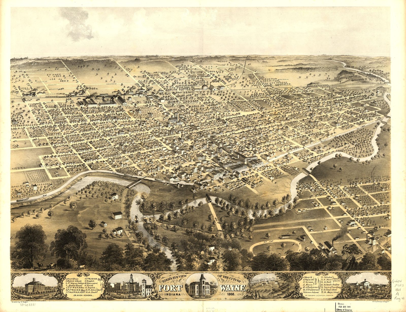
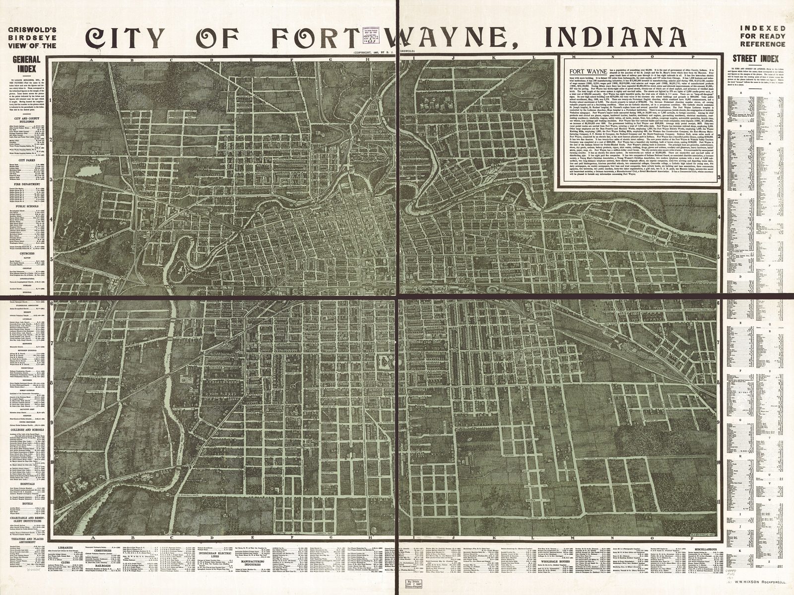
Between the survey and the photograph, the city was pictured from an imaginary altitude. Albert Ruger's Bird's eye view of the city of Fort Wayne, Indiana (Chicago Lithographing Co., 1868) is the first of the panoramic views: the…
Working City Maps, 1874–1965
Alongside the portraits ran the tools. The State Library's earliest city sheet after the Whistler plan is the Map of the city of Fort Wayne, Ind.; compiled from the original records to date , lithographed by Braden & Burford at…
Sanborn: The Building-by-Building Record, 1885–1951
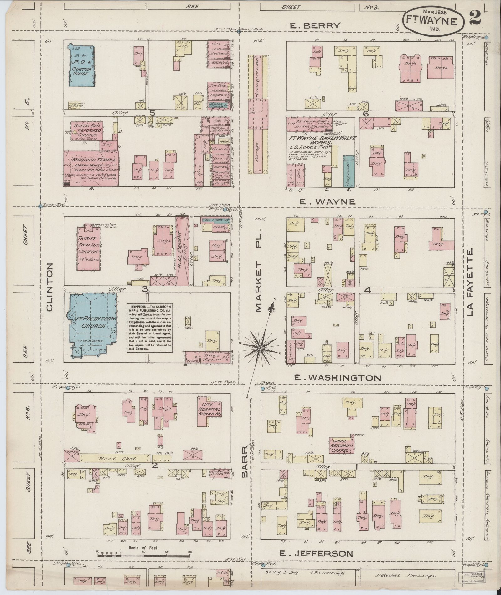
The most exact maps ever made of Fort Wayne were drawn for fire insurance companies. The Sanborn Map Company of New York sent its surveyors through American cities to record, at fifty feet to the inch, what an underwriter needed…
Plans Drawn as Maps, 1909–1958
Some maps in the record are arguments about a city that did not exist yet. The Parks & Plans chapter tells the Robinson report of 1909 (presented that year, in print 1910) and George E. Kessler's engagement that followed; the…
Roads, Mail, and Highways, 1910–1981
The county's own maps of the automobile age began, fittingly, with the mail. The U.S. Post Office Department's Map of Allen county showing rural delivery service (Washington, 1910) drew the rural free delivery routes out of every…
The Topographic Record: USGS and the Quadrangles
The federal topographic survey reached Fort Wayne late and at small scale first. The city appears on the U.S. Geological Survey's 1:250,000 Fort Wayne sheet — one degree by two, the whole of northeastern Indiana on a page — in…
From the Air, 1912–2018
Fort Wayne's first famous aerial image came early: on October 20, 1912, the pioneer aviator Art Smith — the city's own "bird boy," whose story the People chapters tell — photographed the Driving Park from his airplane, a view of…
The Living Map: GIS, iMap, and Data Fort Wayne
The modern map of Fort Wayne is not an object but a service, and it has an author worth naming. Allen County's iMap portal (acimap.us) serves the county's geographic data through public viewers — Data, Engineering, Property…